Chaotic, mismatched data
Public locates arrive as scattered PDFs, emails, and sketches that rarely align, forcing guesswork about what’s underground.
Locate management system
We coordinate Call Before You Dig tickets, public locates, and private sweeps, then deliver GPS-mapped information your crew can actually use.

The problem we take off your plate
You shouldn’t need a second full-time job just to keep tickets, PDFs, and paint marks in the same conversation. Public locates are necessary. They are also often incomplete for private plant, and they rarely arrive as one clean drawing. That’s the scramble we handle.
Structure Scan has been producing GPS-referenced locate information for years. Locate management is how we turn that field work plus the public process into a single, usable package instead of a folder of mismatched files.
Public locates arrive as scattered PDFs, emails, and sketches that rarely align, forcing guesswork about what’s underground.
Tickets, reviews, and tracking consume hours, introduce errors, delay projects, and risk fines.
Inaccurate, vague, or confusing locates put crews at risk and invite utility strikes.
Tickets expire quickly. Marks fade or get destroyed, triggering re-submissions and downtime.
How it works
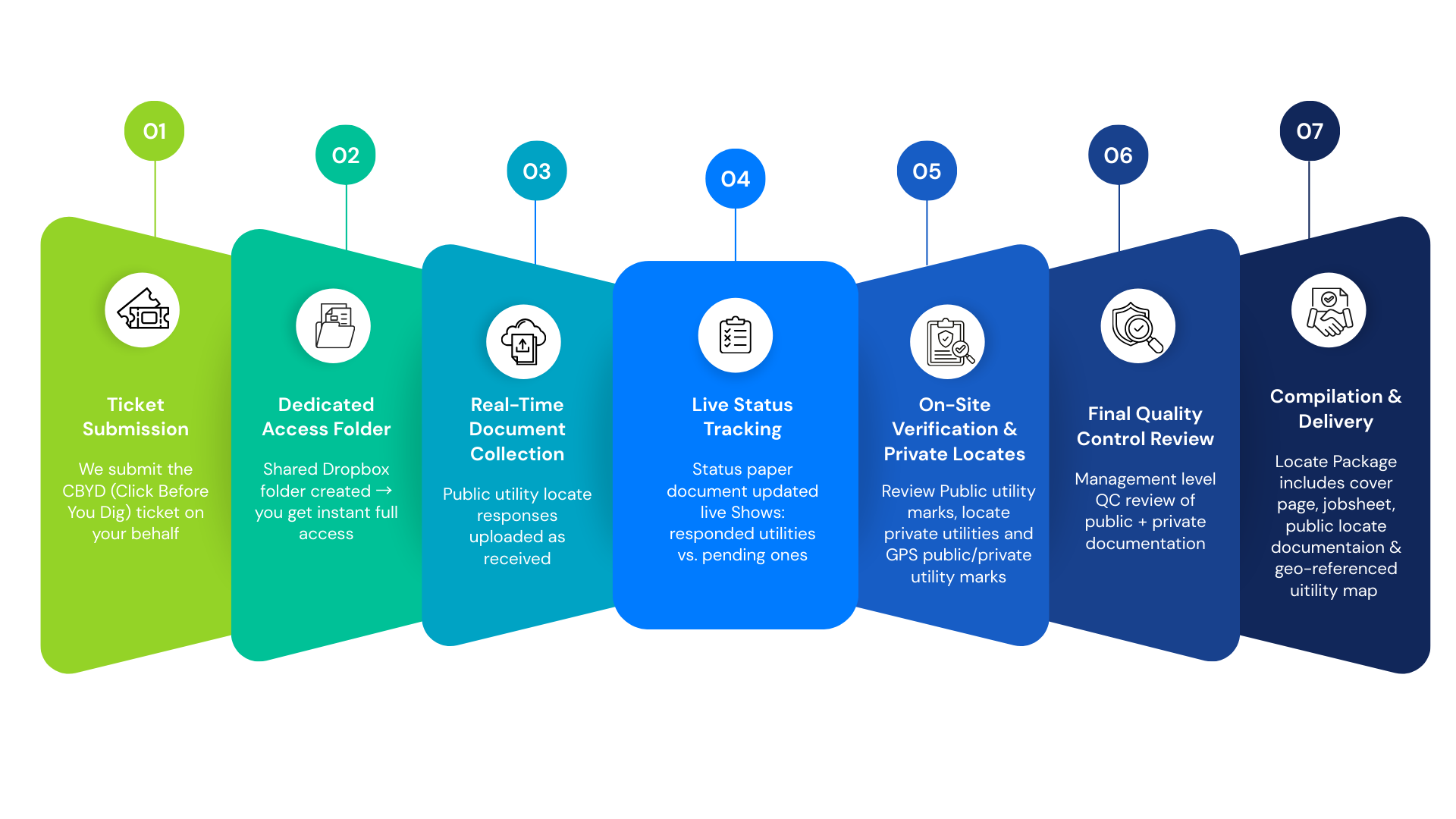
Call Before You Dig ticket coordination so public utilities are requested and tracked.
Public locates gathered and reviewed against the work area.
Private sweeps for services the public process does not cover.
GPS-mapped deliverables that document what was found, where, and in a format you can keep.
Utility map gallery
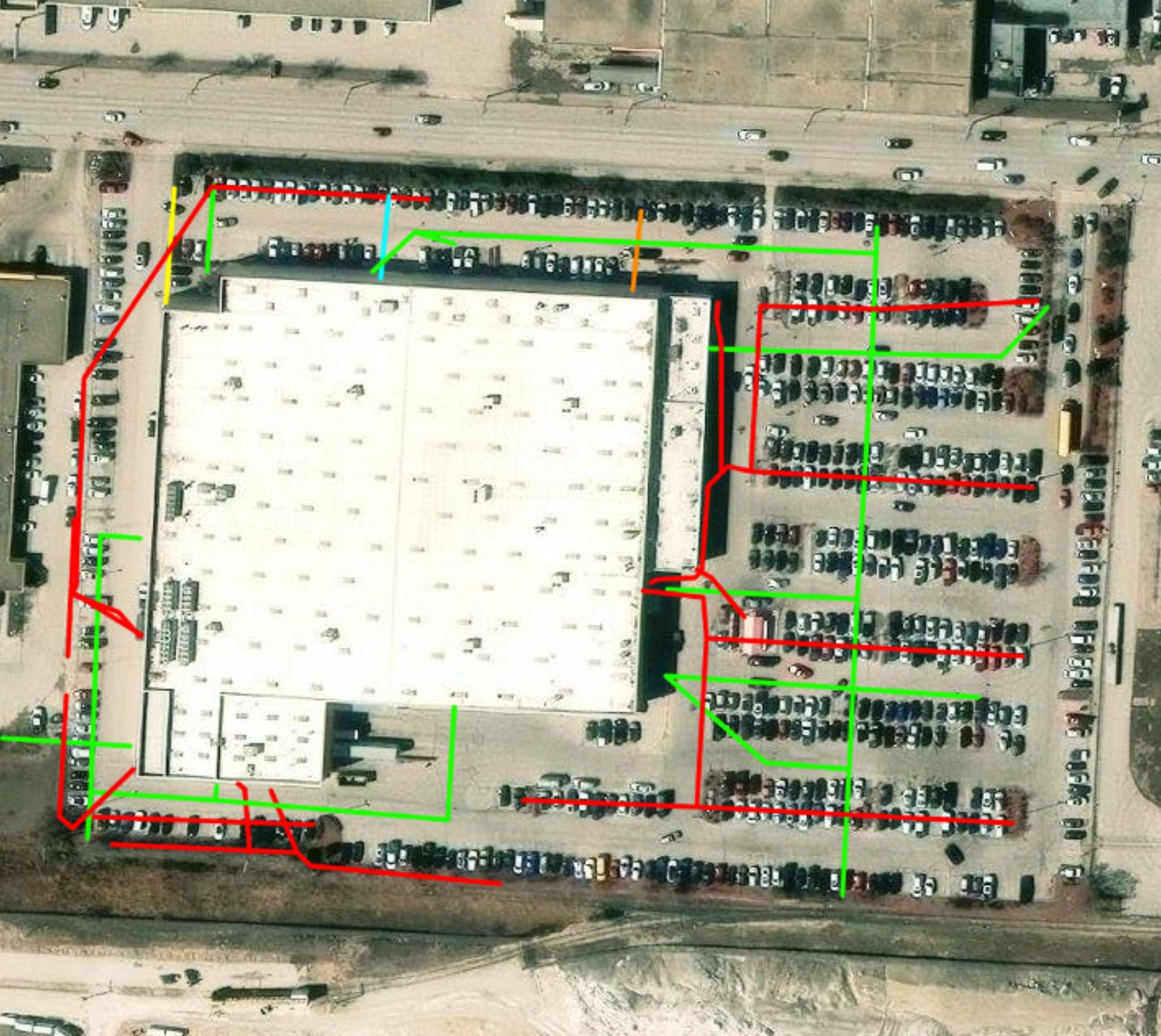
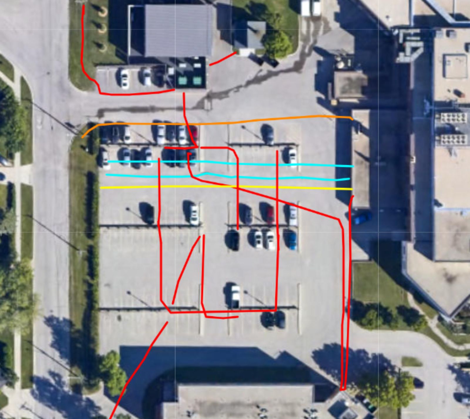
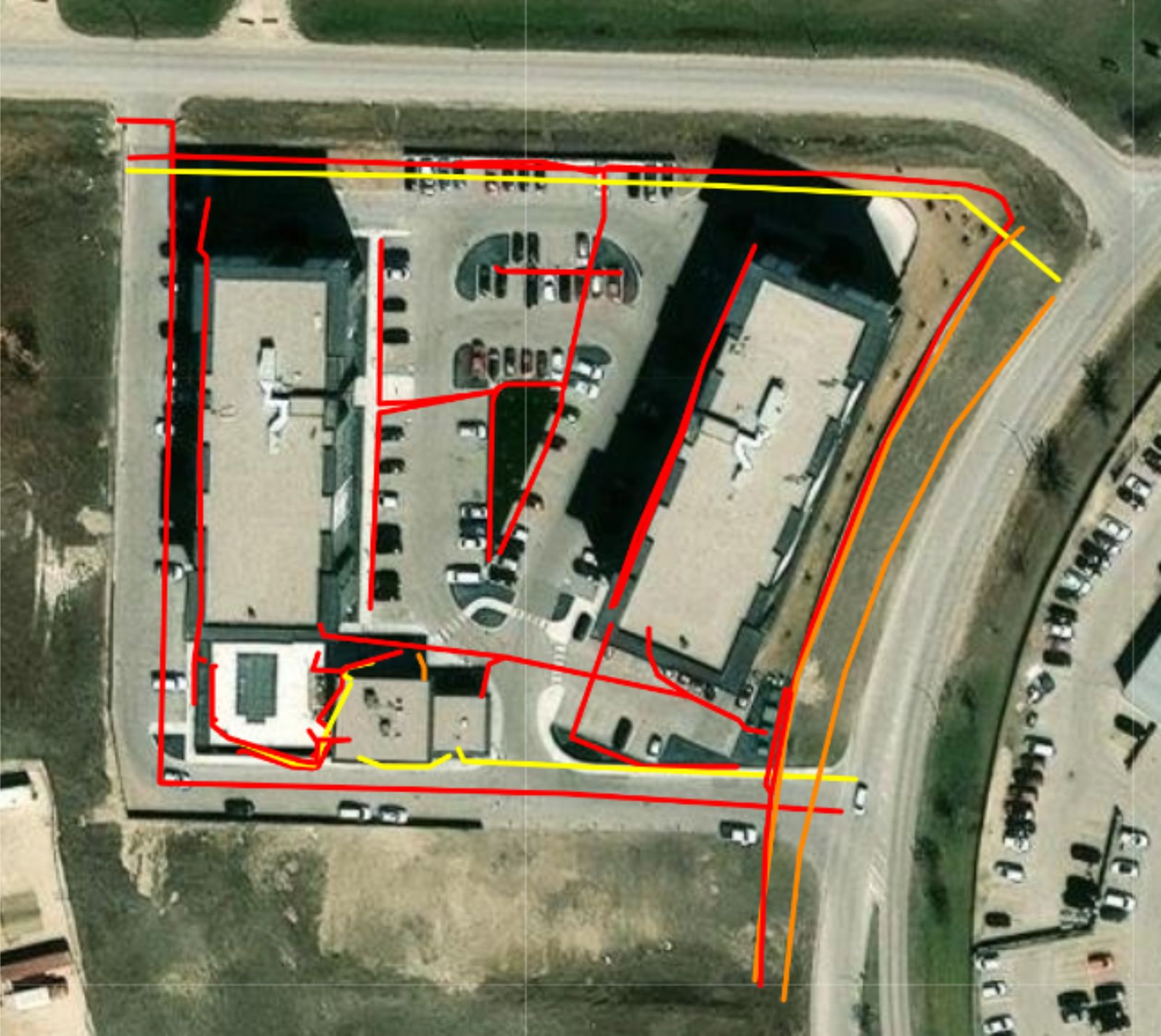
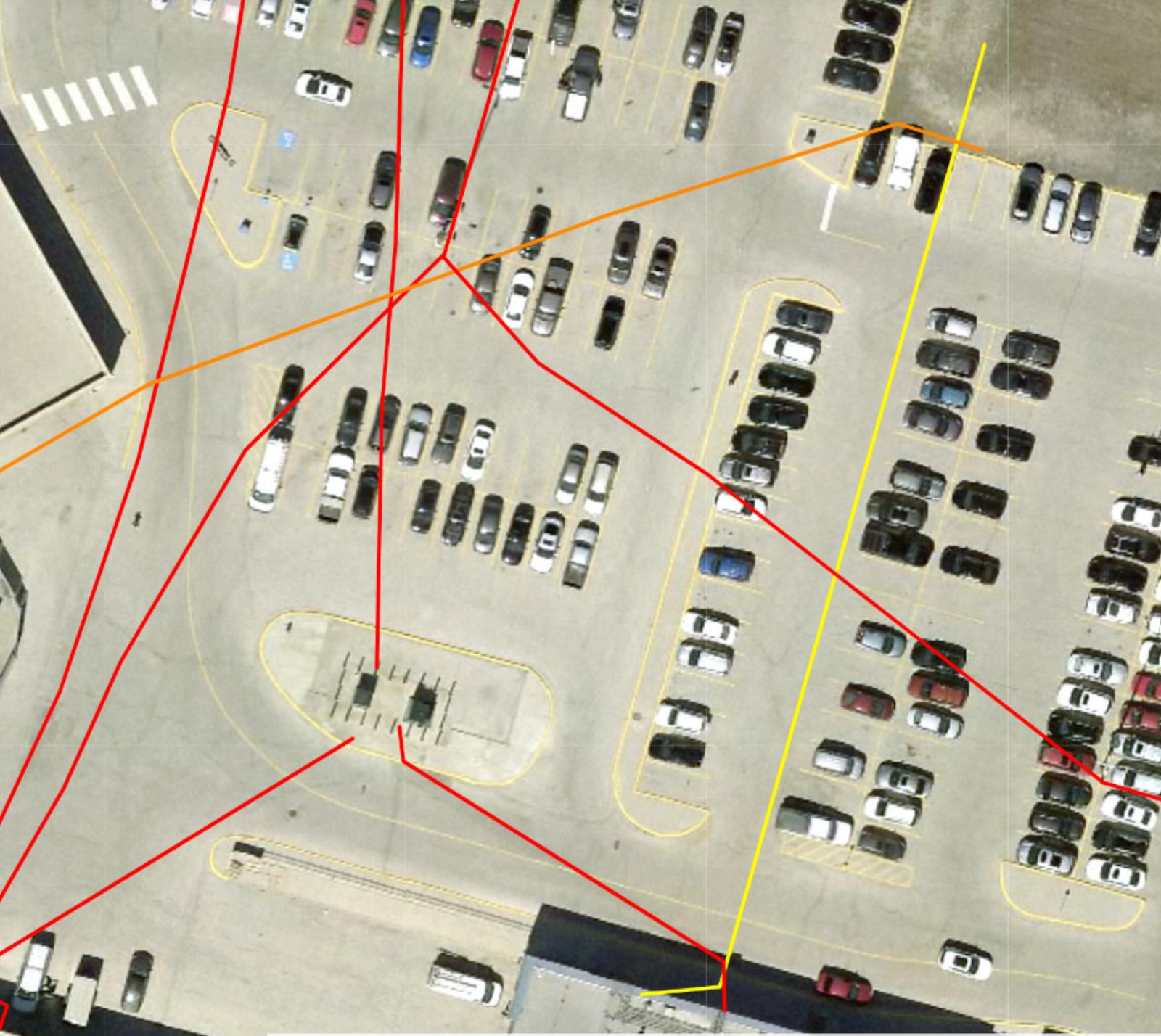
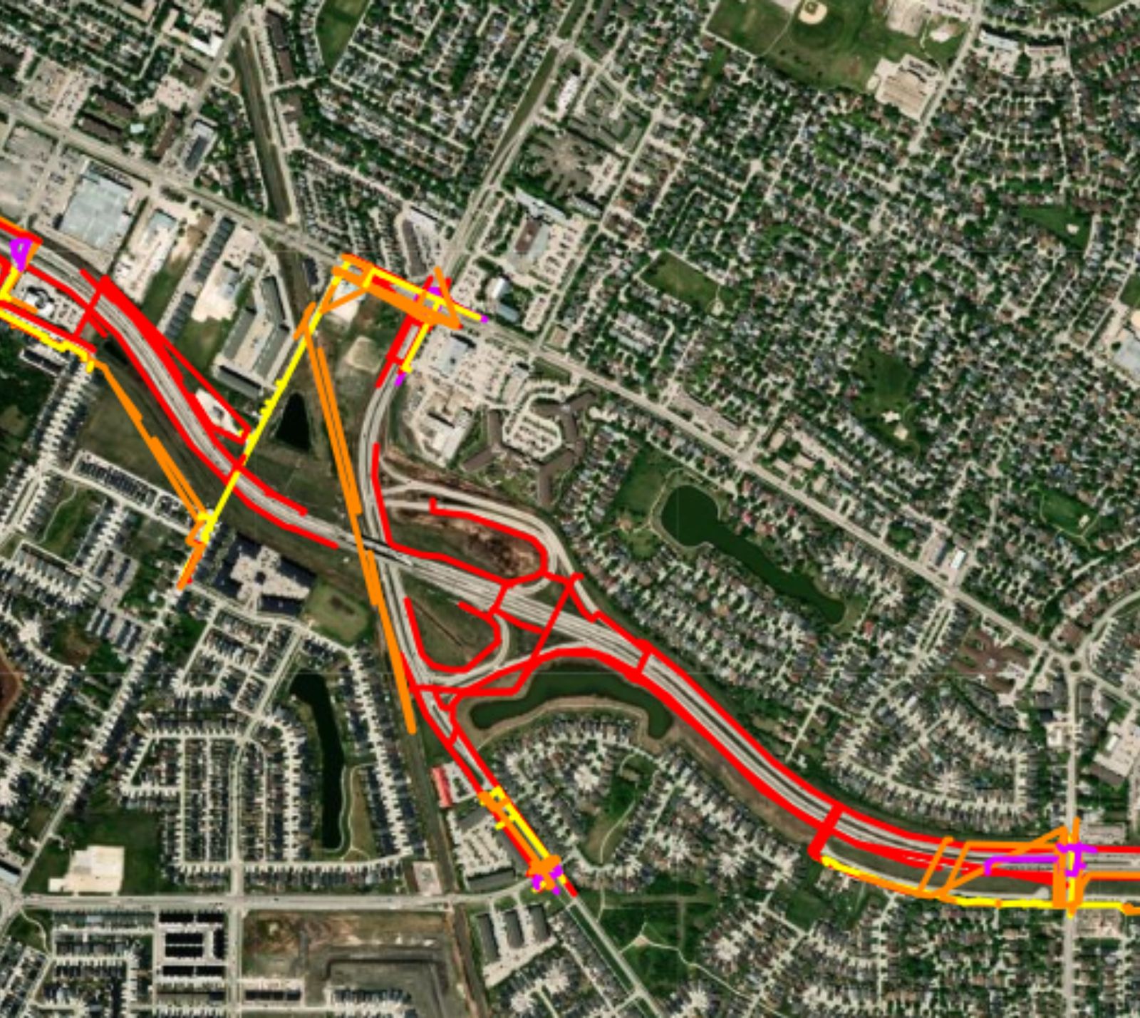
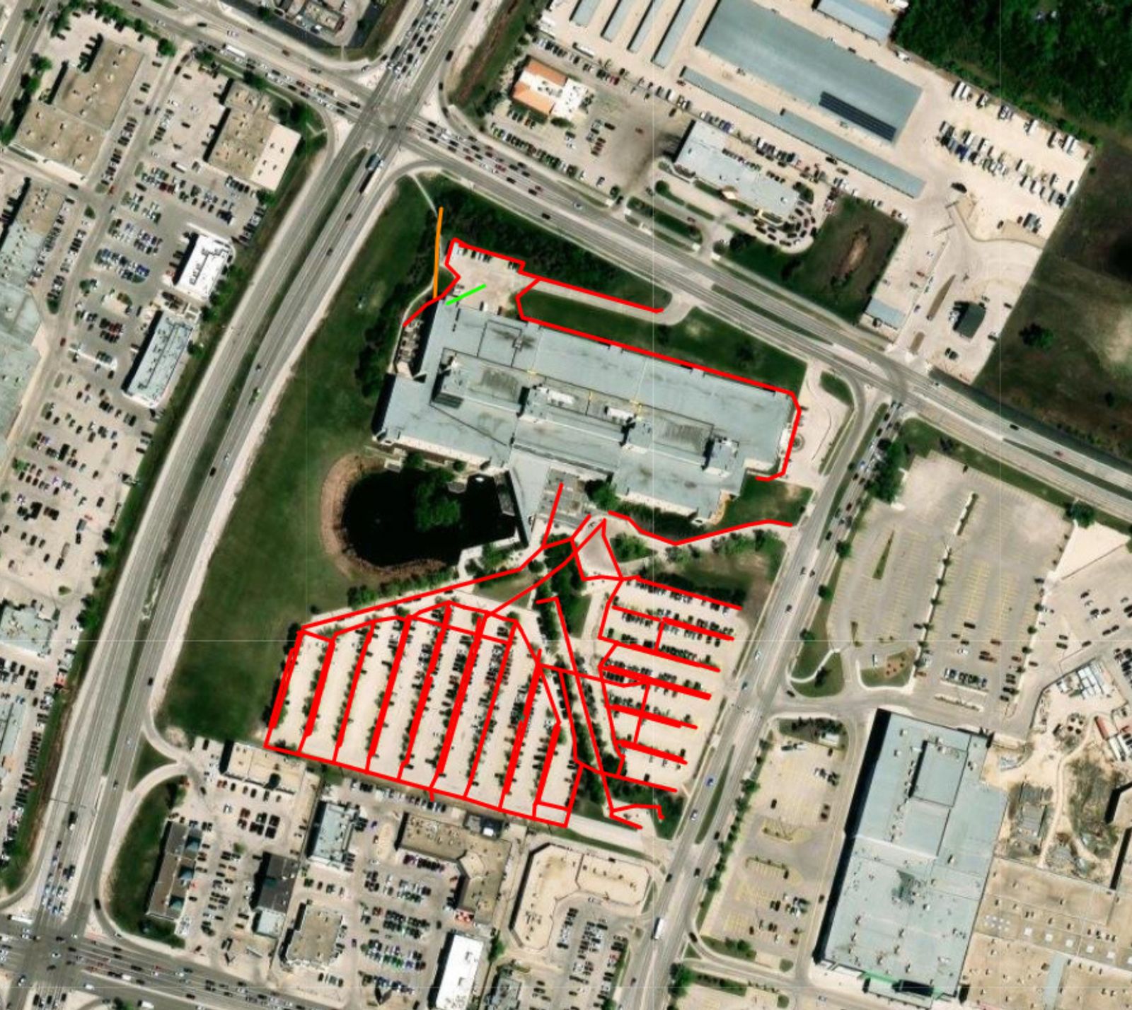
Parking lots, building envelopes, and larger corridors—colour-coded paths you can share with the superintendent, the engineer, and the next contractor.
Call the Winnipeg office or send a note. We’ll help you pick the right service—no jargon wall, just a clear next step.